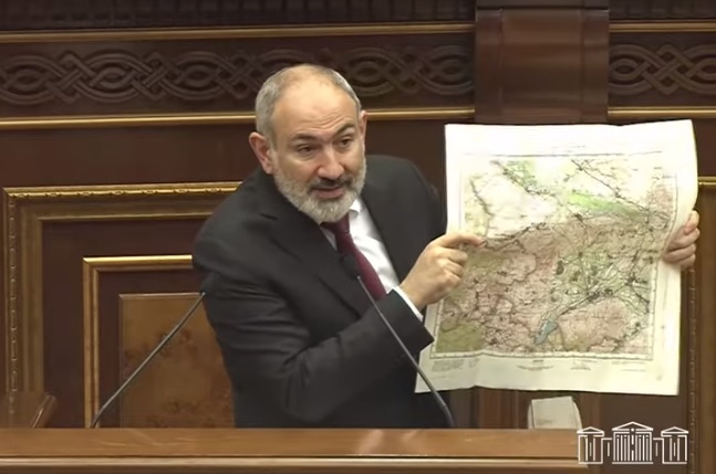
During the Armenian government’s question-and-answer session at the National Assembly Wednesday, MP Arusyak Julhakyan of the ruling majority Civil Contract Faction asked Prime Minister Nikol Pashinyan to clarify with which maps the Armenia-Azerbaijan border delimitation is being carried out.
In response, Pashinyan noted that the de jure borders of Armenia that existed at the time of the collapse of the Soviet Union are being reproduced, and this means that a new border is not being created. Then, the premier showed the maps by which the border delimitation of Armenia is carried out. They are, in fact, the 1976 maps of the USSR General Staff, which are based on the 1969 maps.
“Having done very thorough work, we have reproduced on maps the entire perimeter of Armenia’s borders, with 19 pages of these maps. We have delimited the borders in Baghanis, Voskepar, Kirants, Berkaber villages [of Tavush Province] on the basis of legally binding maps regarding the reproduction of the de jure borders that existed at the time of the collapse of the USSR. I am aware that there was a debate with the opposition in the National Assembly, a question was raised as to how much is the sovereign territory of Armenia, and there was no concrete answer to that question. We say that the territory of Armenia is 29,743 square kilometers, this is the concept of real Armenia, those who are the bearers of historical Armenia should understand this logic correctly,” Pashinyan said.


